Natural Earth Projection Tool for ArcMap |
|||||||||||||
Download Natural Earth Projection Tool (17k) |
|||||||||||||
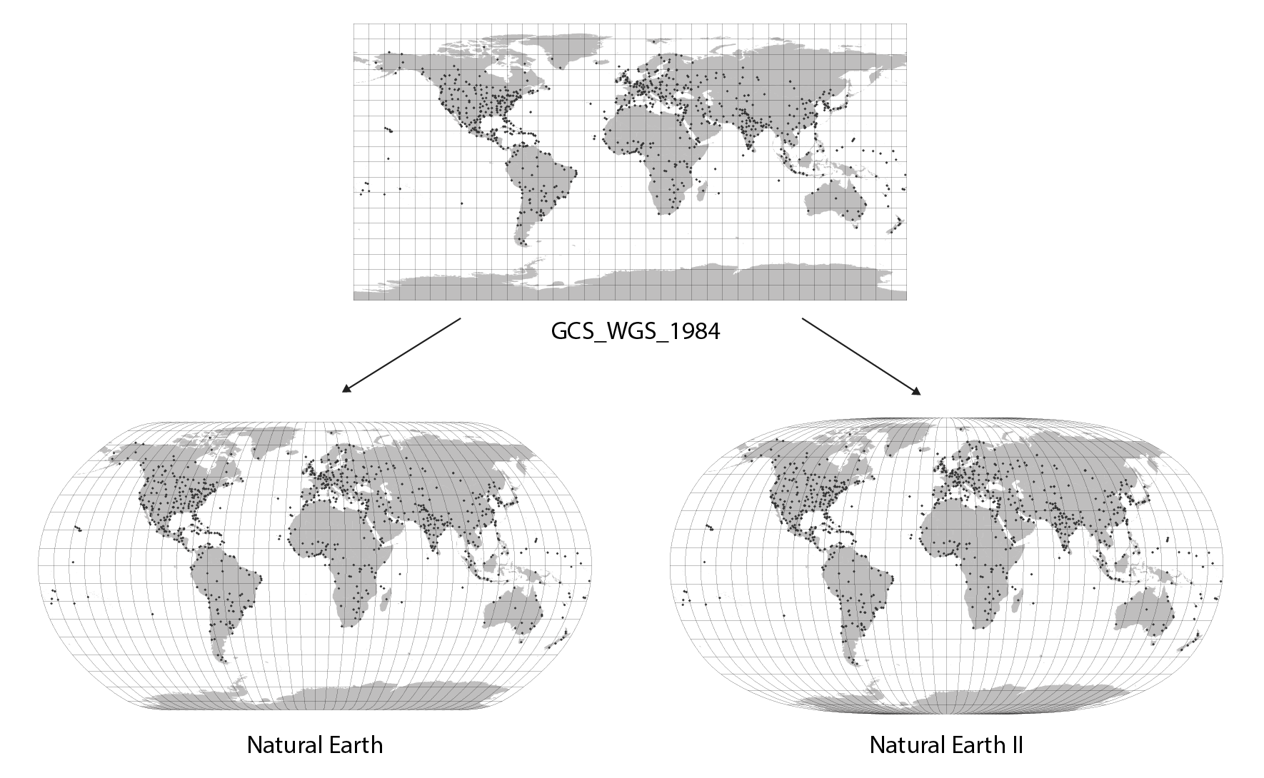
Natural Earth Projection Tool is a free toolbox for ArcMap that projects shapefiles from the GCS_WGS_1984 reference system into the Natural Earth or Natural Earth II projection (see illustration bellow). The user can also define a central meridian. The tool was created by Bojan Savric, a member of the Cartography and Geovisualization Group at Oregon State University. To access data in shapefiles, the Python Shapefile Library is used. The intended users of Natural Earth Projection Tool are map makers working with ArcMap 10.0 or later versions on Windows. |
|||||||||||||
 |
|||||||||||||
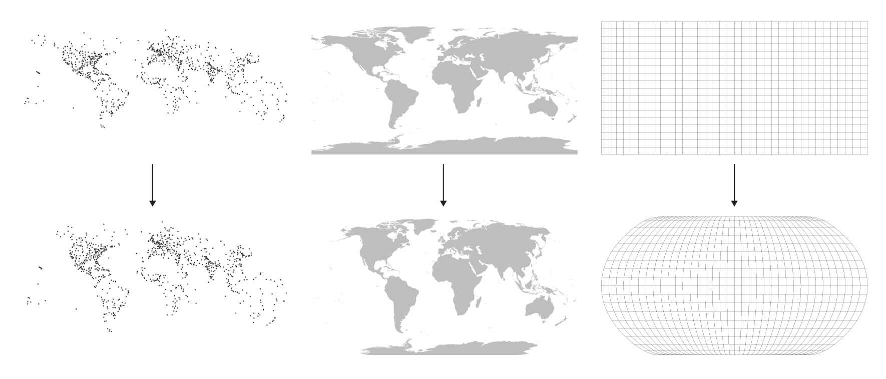
The list of the map projections in ArcMap does not include any of the Natural Earth projections. Natural Earth Projection Tool solves this problem. As shown in the illustration below, this tool projects shapefiles (points, polygons, and polylines) stored in the GCS_WGS_1984 coordinate system into one of the Natural Earth projections. |
|||||||||||||
 |
|||||||||||||
Installation and Use |
|||||||||||||
To install Natural Earth Projection Tool in ArcMap 10.0 or later, on Windows, do the following: 1) Download and un-Zip the Natural Earth Projection Tool. 2) Copy NaturalEarth_ArcMap10.tbx toolbox and both python scripts (shapefile.py and NaturalEarthTransformation.py) into a common folder, where you have stored your own tools and scripts for ArcMap. Note that all three files must be in the same folder. 3) Open ArcMap and in the Catalog window establish a folder connection to the folder where the Natural Earth Projection Tool is stored. |
|||||||||||||
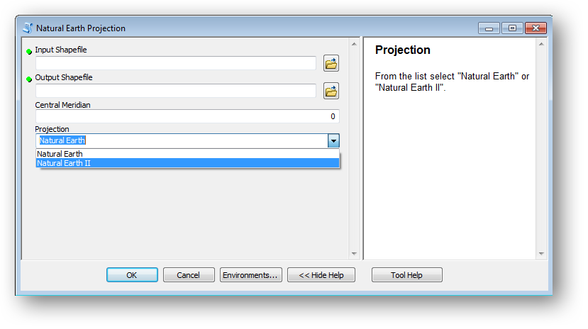
Using the Natural Earth Projection Tool is simple: 1) Open ArcMap and in the Catalog window run the script Natural Earth Projection. It will open a dialog window (see below). |
|||||||||||||
 |
|||||||||||||
2) Select a shapefile you want to project. Note that the input shapefile must be stored in the GCS_WGS_1984 reference coordinate system. 3) Define a path and name of the output shapefile. The output shapefile will not have a specified projection, since none of the Natural Earth projections exist in the ArcMap projection library. 4) Specify longitude of the central meridian. The value should be between -180 and 180 degrees. 5) From the list select the Natural Earth projection or the Natural Earth II projection. 6) At the end, confirm your choice by clicking OK. The script will start and will provide background-processing messages. |
|||||||||||||
Notes and Use Limitations |
|||||||||||||
• Both projections are supported in ArcGIS since version 10.4. • The Natural Earth Projection Tool was created in ArcMap 10.0. Therefore, it can only be used in ArcMap 10.0 or later versions on Windows. • The Natural Earth Projection Tool only works for a shapefiles stored in the GSC_WGS_1984 reference coordinate system. • The output shapefile does not have a specified projection since none of the Natural Earth projections exist in the ArcMap projection library. • Units of the output shapefile are meters. This might result in an incorrect scale in the ArcMap toolbar. • The Natural Earth Projection Tool creates some intermediate shapefiles in the "C:\TEMP\" folder, which are deleted at the end. This happens only when the shapefile contains polygons or polylines and the value for the central meridian differs from zero. If an error occurs, the user should manually delete the intermediate shapefiles in this folder via ArcCatalog. • The input shapefiles should not include features without any or with only one anchor point unless there is a shapefile with a point data type. If an input shapefile contains those features, an error will occur. |
|||||||||||||
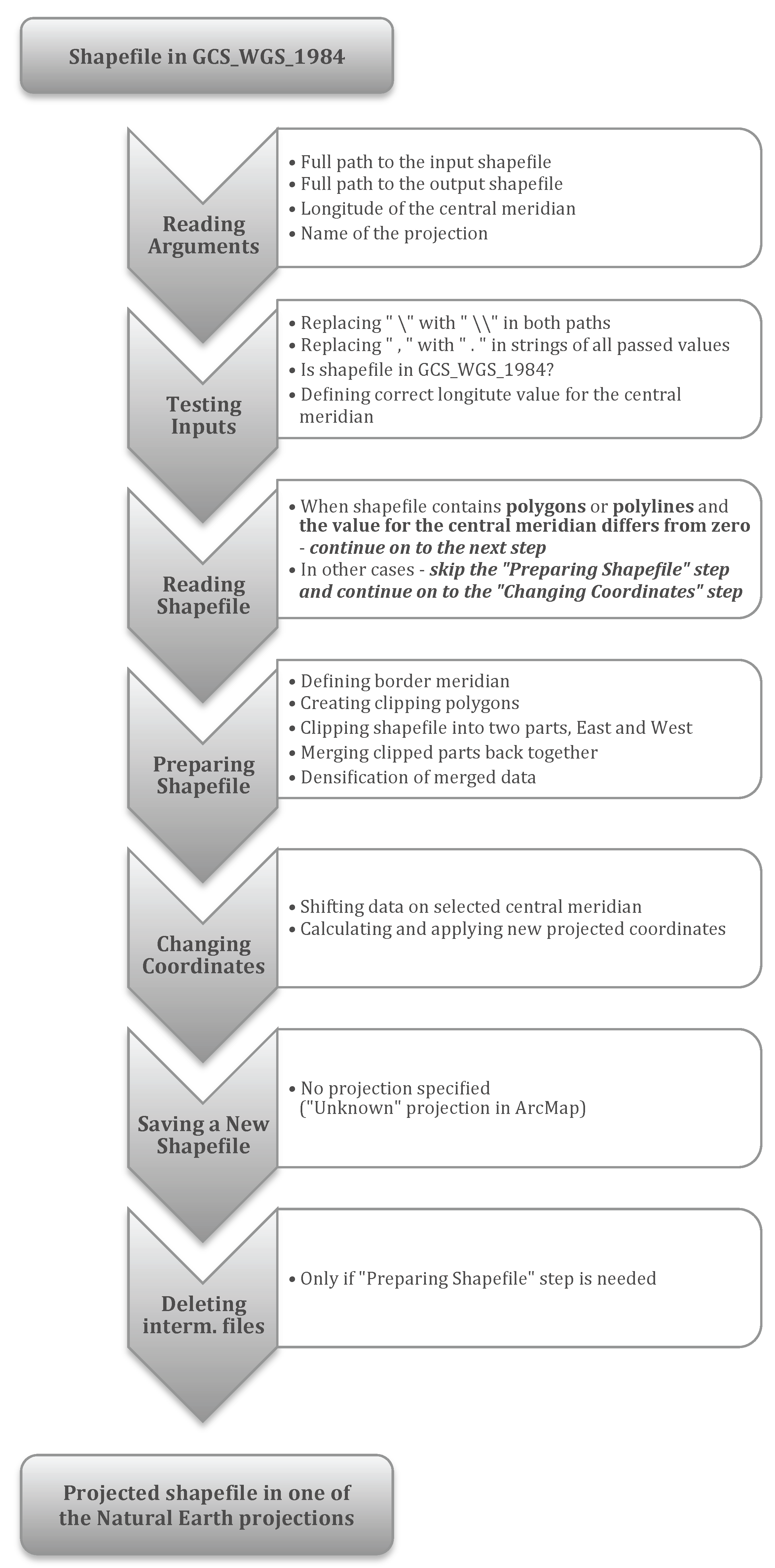
Further Explanation of the Tool's Script Structure |
|||||||||||||
 |
|||||||||||||
Acknowledgments |
|||||||||||||
The author wishes to thank Nicholas Arnold, Bernhard Jenny, Johannes Liem, Brooke Marston, and Charles Preppernau (all Oregon State University) and Jacob Wasilkowski (Clark University) for their help, comments, and testing the tool. |
|||||||||||||
|
|||||||||||||