Projection Wizard
Online Map Projection Selection Tool
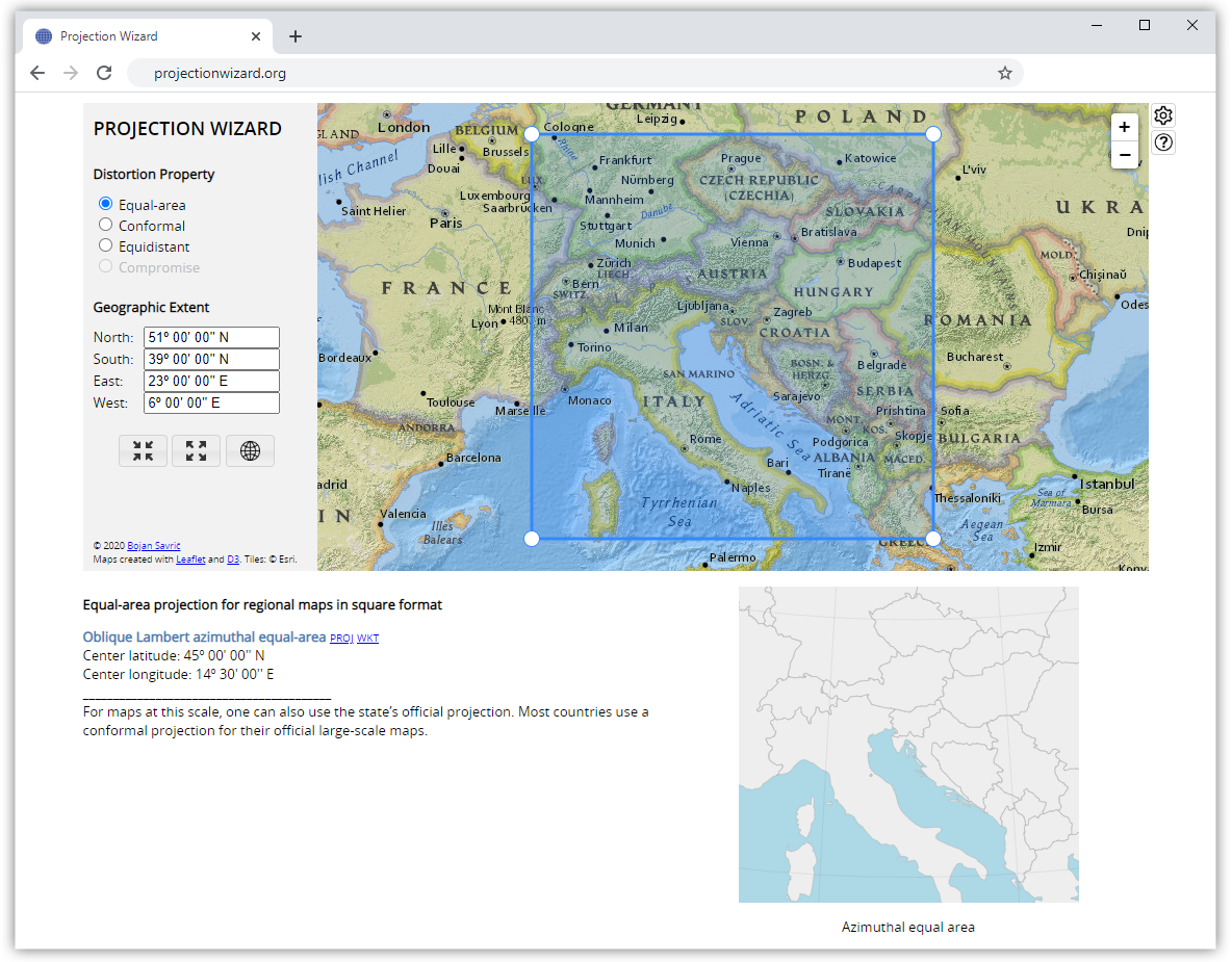
Projection Wizard is a web application that helps cartographers select an appropriate projection for their map. Depending on the extent and the distortion property of the map, the application proposes a projection, along with projection parameters (such as standard parallels).
Featured by GIS Lounge, Maps Mania and ISPRS SC Newsetter.
2020 New functionalities where added and user interface changes where made to the tool.
2017 Henry Johns Best Paper Award by the British Cartographic Society
Other Tools and scripts
Natural Earth Projection Tool for ArcMap
A free toolbox for ArcMap that projects shapefiles to the Natural Earth or Natural Earth II projection.
Both projections are supported in ArcGIS since version 10.4.
Projection Code Libraries
Java Map Projection Library
JMapProjLib is a Java port of the popular PROJ.4 map projection library. Original port by Jerry Huxtable, now maintained by Bernhard Jenny.
CanvasMap
CanvasMap is a JavaScript library for experimenting with map projection equations, developed by OSU Cartography and Geovisualization Group. It reads shapefiles and renders world maps with HTML5 Canvas.